Choquequirao Trek 3 days
- +1k Reviews | 3 days

Explore Choquequirao Trek 3 days by Lodge
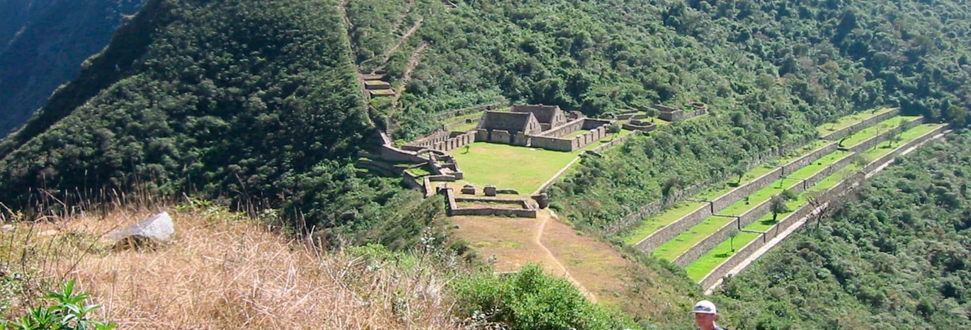
Choquequirao trek 3 days, walking tourism, It is located northeast of the city of Cusco, between the Apurimac river and the Vilcabamba mountain range, where the Nevado del Salkantay stands out with a height of 6,271 meters above sea level (20575 feet) . This tour offers the possibility of seeing some species that are in danger of extinction, such as the Andean condor, the puma and the spectacled bear. This area served as a refuge and natural fortress for the sixteenth Inca resistance movement of the sixteenth century, around this area is preserved the oral tradition that there is “El Dorado”, still hidden by archeology.
 Duration Duration |
3 days |
 Tour type Tour type |
|
 Difficulty Difficulty |
Intermediate |
 Guide Guide |
Inglés, español |
 Group size Group size |
6 to 10 |
 Maximum altitude Maximum altitude |
3700 masl |
Itinerary
Day: 01 Cusco - Cachora
We start picking you up from your hotel between 3:30 to 4:00 am aprox. Leaving Cusco, we will head towards the town of Cachora aprox. 3:30 hours of travel from Cusco, we will stop for 30 to 45 minutes to have breakfast. Afterwards we will continue to the place called Capulioc, where we will start the hike to Marampata. We will continue downhill for about 2:30 hours. Until we reach Chiquisca where we have lunch. After lunch and a short rest, we continue hiking for about 4.30 hours towards Marampata, one of the strongest roads in Cusco. We will arrive at our lodge, where we will have a delicious dinner and spend the night.
Day: 02 Marampata - Choquequirao - Marampata
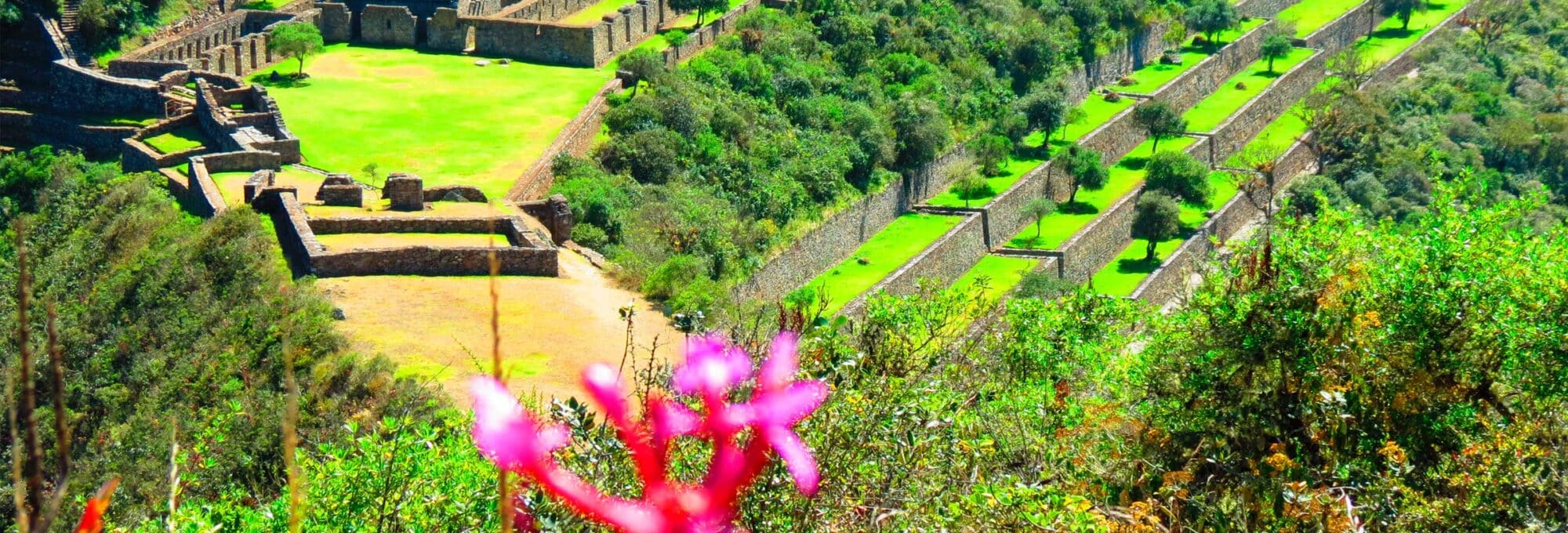
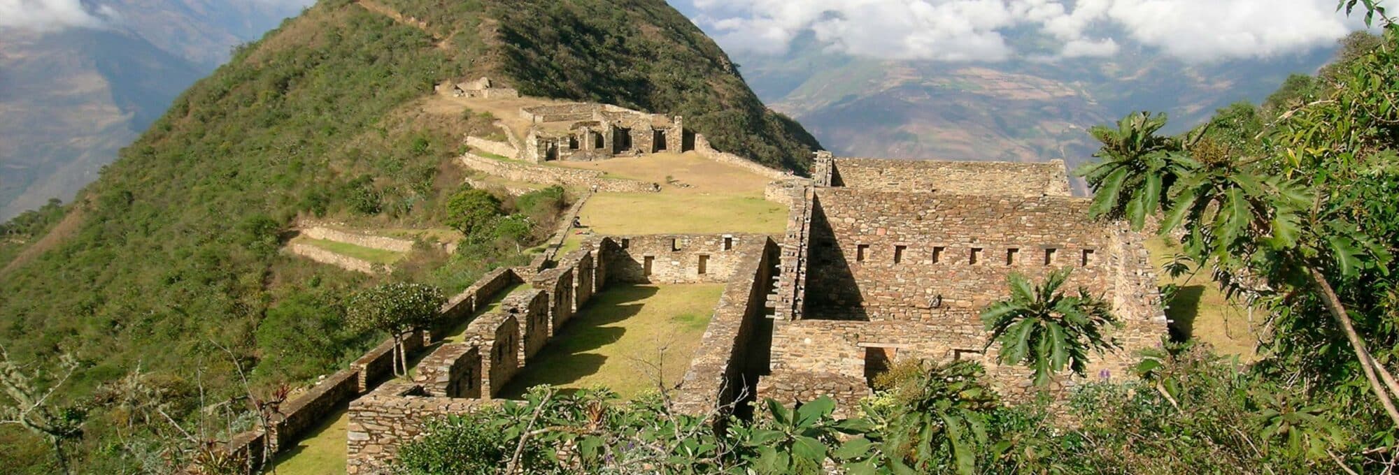
After enjoying our buffet breakfast, we will start our hike to the Choquequirao Archaeological Complex for approx. 2 hours, the entire Choquequirao tour will be explained by our guide who will explain the importance of the archaeological complex for the Incas. Which is considered as the “sacred sister” of Machu Picchu, because there are several similarities, only a third part of this archaeological complex has been discovered and more and more things are being discovered.
After our visit we will have a picnic lunch in Choquequirao, then descend to Pajchayoc (Pajchayoc Waterfall) and return to Marampata for dinner and end our day with a comfortable stay in our lodge.
Day: 03 Marampata - Capulioc - Cusco
At dawn at 5:00 am approx, after a small snack, we will start our hike to Chikisca, where we can have breakfast and take a short break, then we will start our last hike and return to Capuliyoc to say goodbye to this fascinating adventure, arriving at Capuliyoc we will have a snack and return to the city of Cusco.
Reseñas
Reviews from our travelers
Over +999 verified reviews on TripAdvisor

Travel with Plan your trip to Peru!
Chat with a local specialist who can help you organize your trip.
Chat nowContact information
+51 913855357 +51 913855357 info@aremikaexpeditions.com Personalized attention in English and SpanishYou may also be interested
$/ per person
$499.00/ per person
$499.00/ per person